Geospatial IV
Using GIS to Visualize Risk in Metro Manila

TOOLKIT / TOOLS / GEOSPATIAL / Geospatial IV
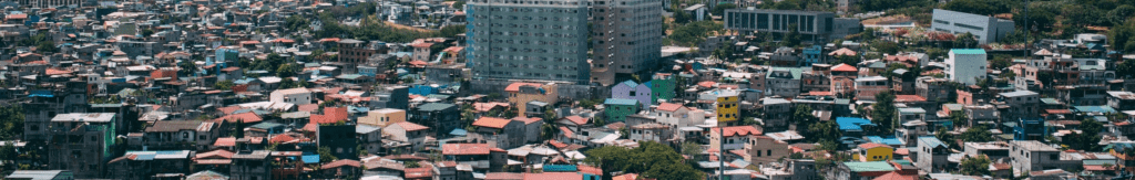
This report aims to visualize and analyze the generated geospatial datasets of the HEVs. Specifically, we considered informality, critical infrastructures, and social vulnerability indicators.
Metro Manila has been experiencing a variety of natural hazards including climate and weather extremes, flooding, storm surge, tropical cyclones, earthquake and others. While these hazards affect the exposed population and land use/cover types, these exposures likewise affect hazards. Also, hazards, exposures and vulnerabilities (HEVs) distribute themselves unevenly across space and time as well as interact with each other. Hazards may be considered catalysts of disasters, while exposures and vulnerabilities are root causes of disasters. The spatial relationships of these HEV variables are not always examined. Hence, this report aims to visualize and analyze the generated geospatial datasets of the HEVs. Specifically, we considered informality, critical infrastructures, and social vulnerability indicators.
The Philippines is known to be a champion in disaster risk governance and, as such, has progressed in terms of understanding the confluence of HEVs towards integrated risk analyses. For this, downscaled climate modeling help better diagnose climate variability and extremes, as these influence exposures and associated vulnerabilities. Risk assessments are then mainstreamed into decision making through various plans (e.g., DRRM, Climate Change Action, and Local Development Plans).
Nevertheless, the failure to understand salient vulnerabilities vs. capacities of communities as well as vital socio-economic assets needed to sustain development and growth, has kept Philippine cities continually at risk to evolving hazards associated with climate change and other factors. Mapping these risks in a manner that will be visually understood by policy-makers will better facilitate solution-seeking and decision-making amongst governance actors. In the same light, deeper understanding of how the elements of risks interact to produce devastation will also allow various stakeholders to look into appropriate innovative measures to enable resilience against powerful hazards.
RELATED STUDIES
Geospatial I 🔗 | Land Cover Change Analysis in Metro Manila and Marikina Watershed Philippines (2009-2018)
Geospatial II 🔗 | Assessment of Land Cover Changes to River Runoff and Scenario-based Flooding
Geospatial III 🔗 | Land use classification over a highly-urbanized region using multi-resolution images
Geospatial V 🔗 | Informal Livelihoods Survey along Commonwealth, Quezon City
RELATED SITES
Climate and Disaster Resilience Laboratory →
Department of Environmental Science →
RESEARCH TEAM

DR. MAY CELINE THELMA VICENTE
Laboratory Head, Geomatics for Environment and Development, Manila Observatory
MS. FLORDELIZA DEL CASTILLO
Senior RS-GIS Specialist, Geomatics for Environment and Development, Manila Observatory

Leave a comment