Geospatial II
Assessment of Land Cover Changes to River Runoff and Scenario-based Flooding

TOOLKIT / TOOLS / GEOSPATIAL / Geospatial II
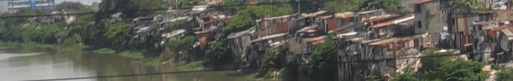
A hydrologic model was developed in this study to characterize the effects of environmental changes, specifically land cover in the watershed scale on the volume and timing of runoff.
This study extends the study of Perez et al. (2017) done for the Coastal Cities at Risk (CCaR) Project of the Manila Observatory (MO) which characterized changes in the channel morphology of the Marikina River and its effects on aggravated flood levels in the area. A hydrologic model was developed to characterize the effects of environmental changes, specifically land cover in the watershed scale on the volume and timing of runoff. The capabilities for satellite-based land cover classification of the Geomatics for Environment and Development (GED) Program of MO were utilized for this purpose. The use of rainfall as an input also sets into place a possibility to integrate climate projections in terms of rainfall intensity duration frequency (RIDF) data for specific areas. In addition, highly urbanized coastal cities with relatively complete ancillary data on physical parameters, as well as exposure and vulnerability variables can be incorporated as new study areas.
RELATED STUDIES
Geospatial I 🔗 | Land Cover Change Analysis in Metro Manila and Marikina Watershed Philippines (2009-2018)
Geospatial III 🔗 | Land use classification over a highly-urbanized region using multi-resolution images
Geospatial IV 🔗 | Using GIS to Visualize Risk in Metro Manila
Geospatial V 🔗 | Informal Livelihoods Survey along Commonwealth, Quezon City
RELATED SITES
Climate and Disaster Resilience Laboratory →
Department of Environmental Science →
RESEARCH TEAM

DR. CELINE VICENTE
Laboratory Head, Geomatics for Environment and Development, Manila Observatory
MS. PATRICIA PARAISO
Former RS-GIS Specialist, Geomatics for Environment and Development, Manila Observatory
MS. FLORDELIZA DEL CASTILLO
Former RS-GIS Specialist, Geomatics for Environment and Development, Manila Observatory

Leave a comment